Culvert Ecologies
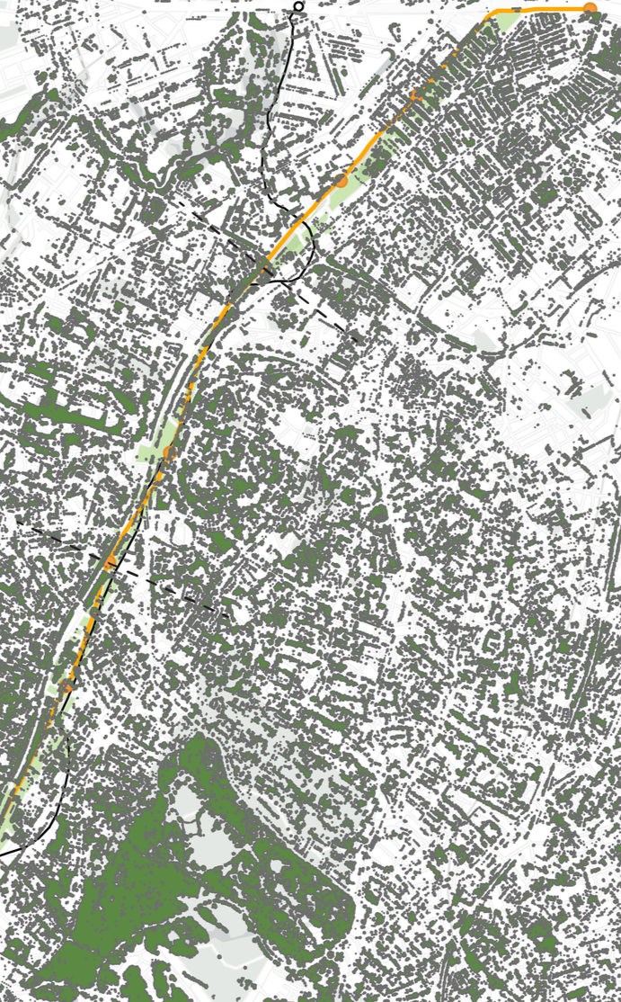
History and Ecology are closely intertwined with their hydrology. As a part of the Southwest Corridor Research Collective, my colleague Madelyn Mackey and I studied the history of the Stony Brook River which is a tributary of the Charles River and provided water which boomed industry and transit through the neighborhoods of Roxbury and Jamaica Plain. The research resulted in a story map which outlined the changing ecology through eras such as Colonial Boston and Urban Renewal.
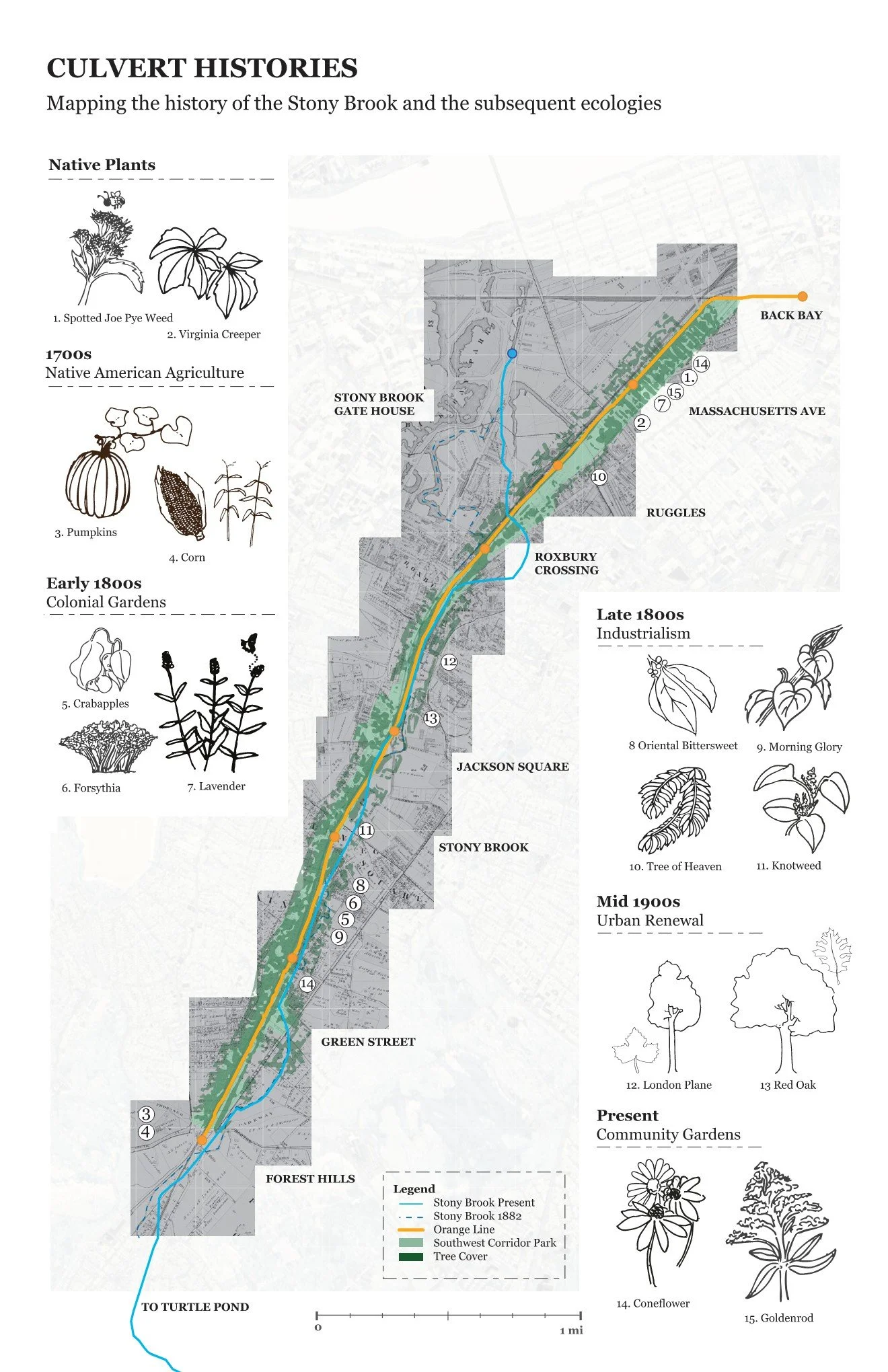
NATIVE PLANTS
Plants we mapped which were native to the New England region
NATIVE AMERICAN AGRICULTURE
Understanding and mapping what plants would be a part of agriculture including squash, beans, and corn
COLONIAL GARDENS
What plants were brought over during Colonial America?
INDUSTRIALISM
As space was acquired and cleared for the potential highway, invasive species began to take over.
URBAN RENEWAL
As space was acquired and cleared for the potential highway, invasive species began to take over.
COMMUNITY GARDENS
The reclamation of the Southwest Corridor to the community is evident in the creation of Community Gardens, which nourish the people along the corridor.
RESEARCH PROCESS
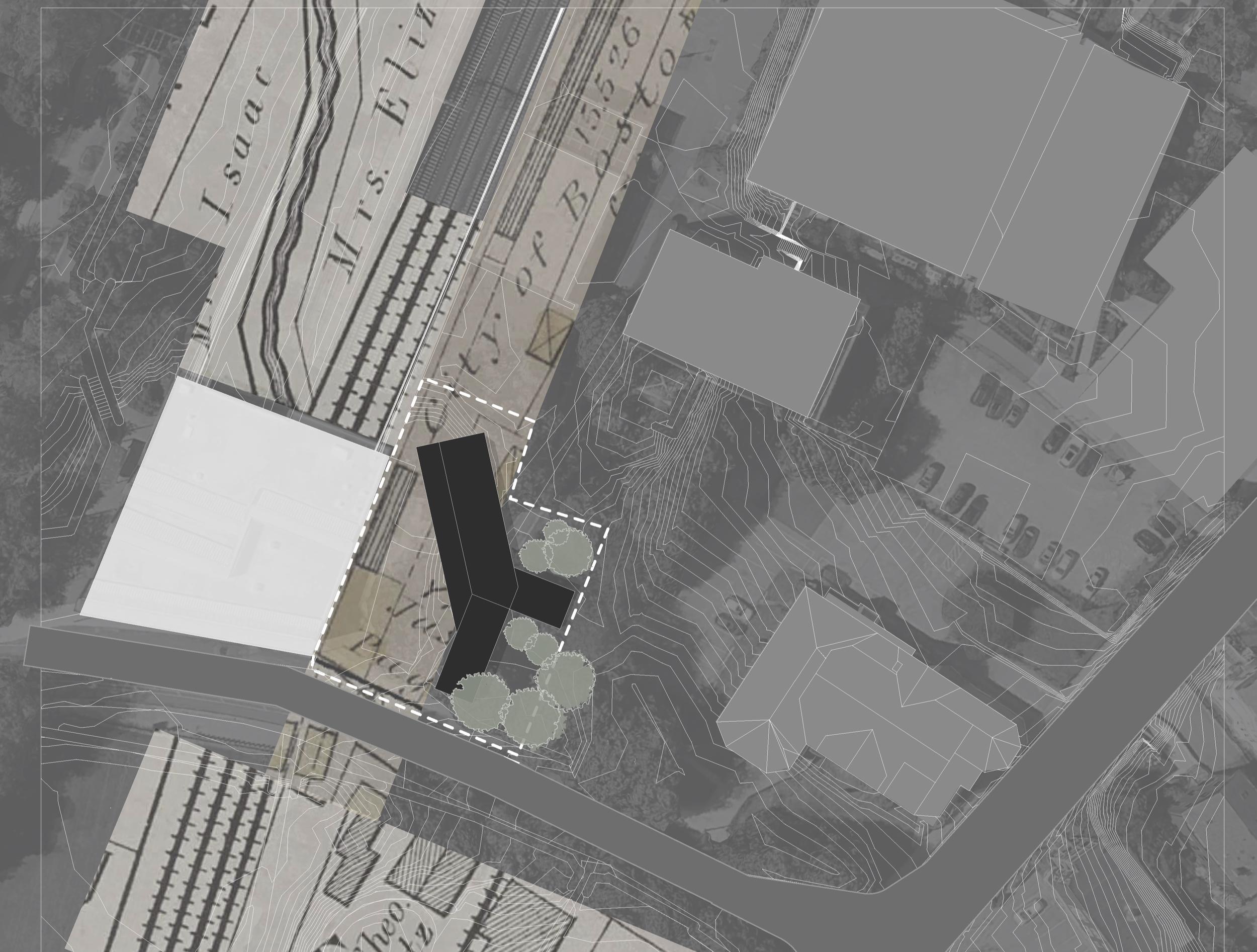
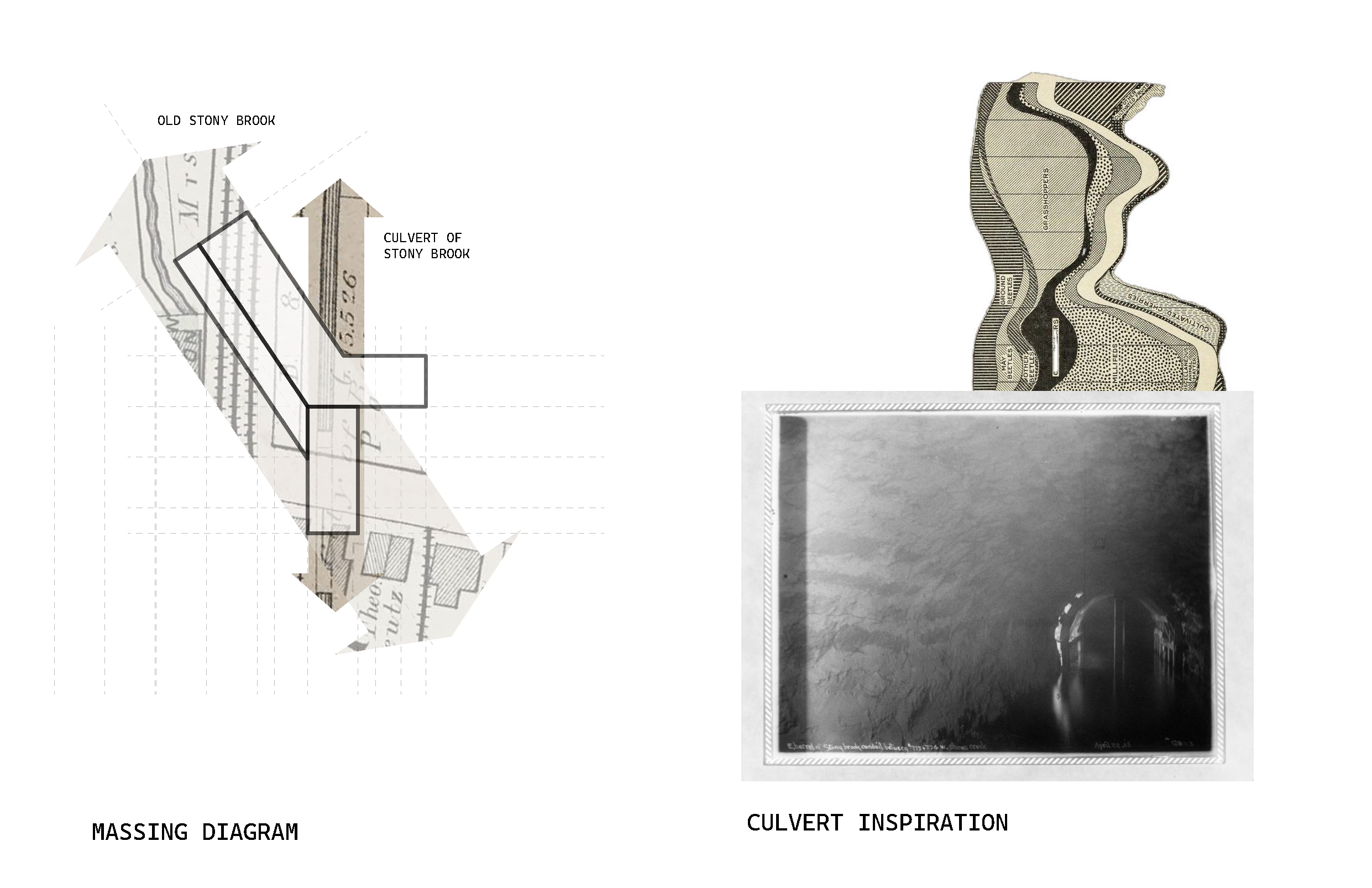
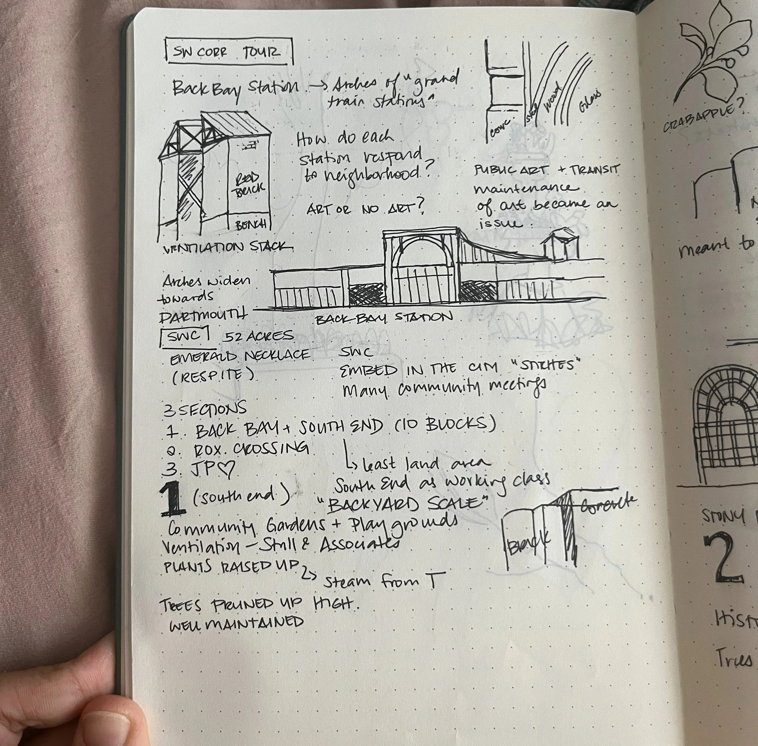
We began with general research regarding the area and the Southwest Corridor, then chose to focus on the Stony Brook River, its connection to transportation and ecology.
-
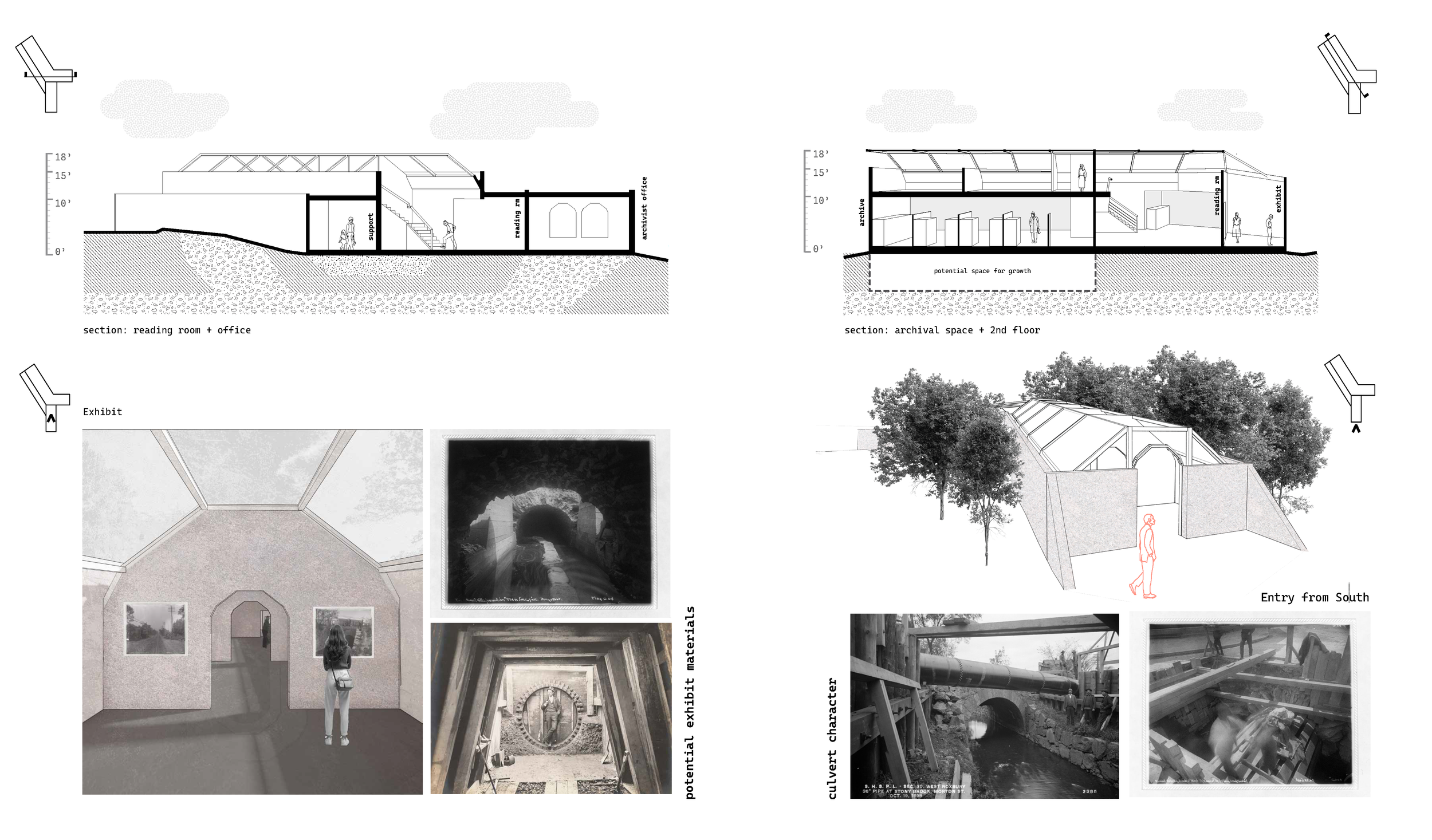
This included a walkthrough along the corridor as well as archiving old editions of the Boston Globe, which document the history of the Stony Brook, from its flooding, embankment, to culverting.
-
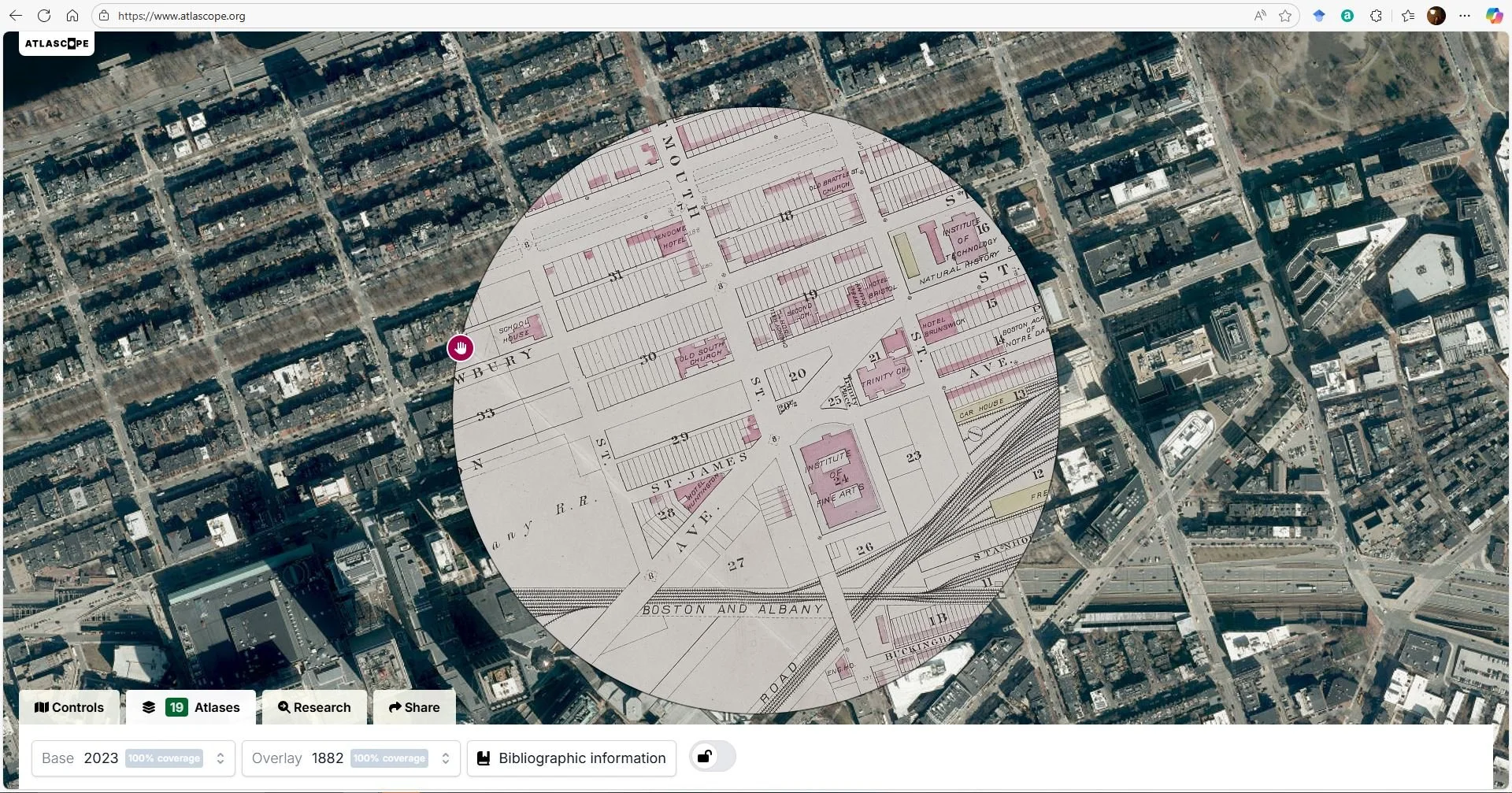
Using the Leventhal Library’s online Atlascope, I stitched together maps dating back to 1870 to understand the path and surroundings of the Stony Brook.
-
A secondary walkthrough focused on identifying existing plant species along the corridor which associated to the history of the Stony Brook.